Ried AMONSTHAL

Beschreibung
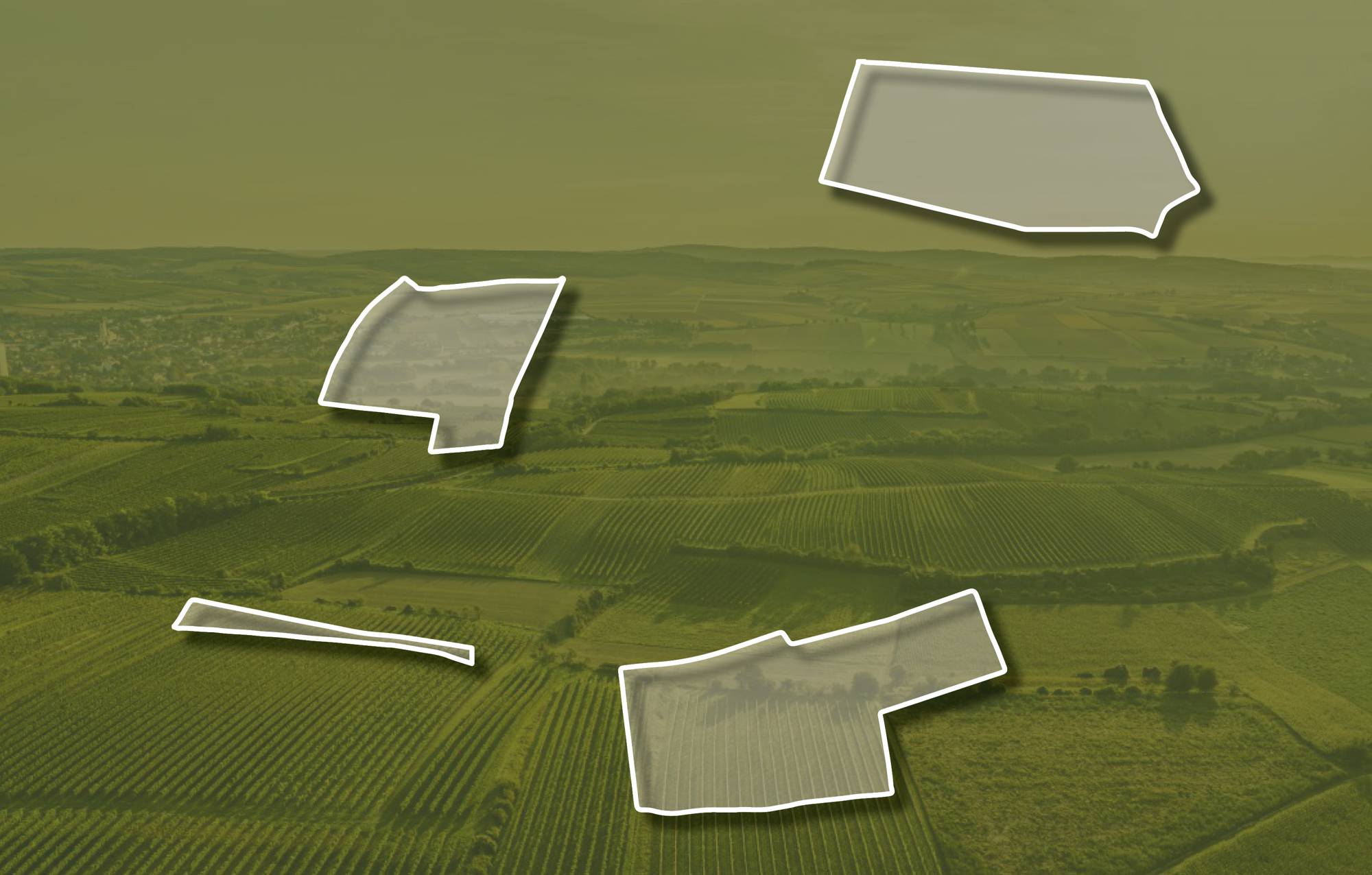
Die Ried AMONSTHAL setzt sich aus vier Teilen zusammen und erstreckt sich über eine Seehöhe zwischen etwa 230 und 300 Meter Richtung Hausberg. Die Weingärten sind vorwiegend nach Süden ausgerichtet. Im Untergrund liegen hier Tone und Schluffe, die vor etwa 17 Millionen Jahren in dem Meer, das damals im Alpenvorland lag, abgelagert wurden. Sie sind aber weitgehend von Löss überdeckt. Löss ist kalkhaltiger Gesteinsstaub (Schluff), der in den vegetationsarmen Kaltphasen der Eiszeit aus dem Alpenraum hier angeweht wurde und jetzt einen lehmig-sandigen, immer kalkigen und gut speicherfähigen Boden mit ausgewogener chemischer und mineralogischer Zusammensetzung bildet.
Sowohl im Franziszeischen Kataster (1822) als auch in der Administrativkarte (1864-1881) sind hier Weingärten eingetragen.
Quellen: ÖWM, BFW-eBOD Digitale Bodenkarte, Riedenatlas Wagram 2021, M. Heinrich et al. 2009, GBA 2015: Blatt 39 Tulln, NÖ Atlas-Land Niederösterreich, www.familia-austria.at


This content cannot be displayed because cookies are disabled.
Change settings here.


