Ried BROMBERG

Beschreibung
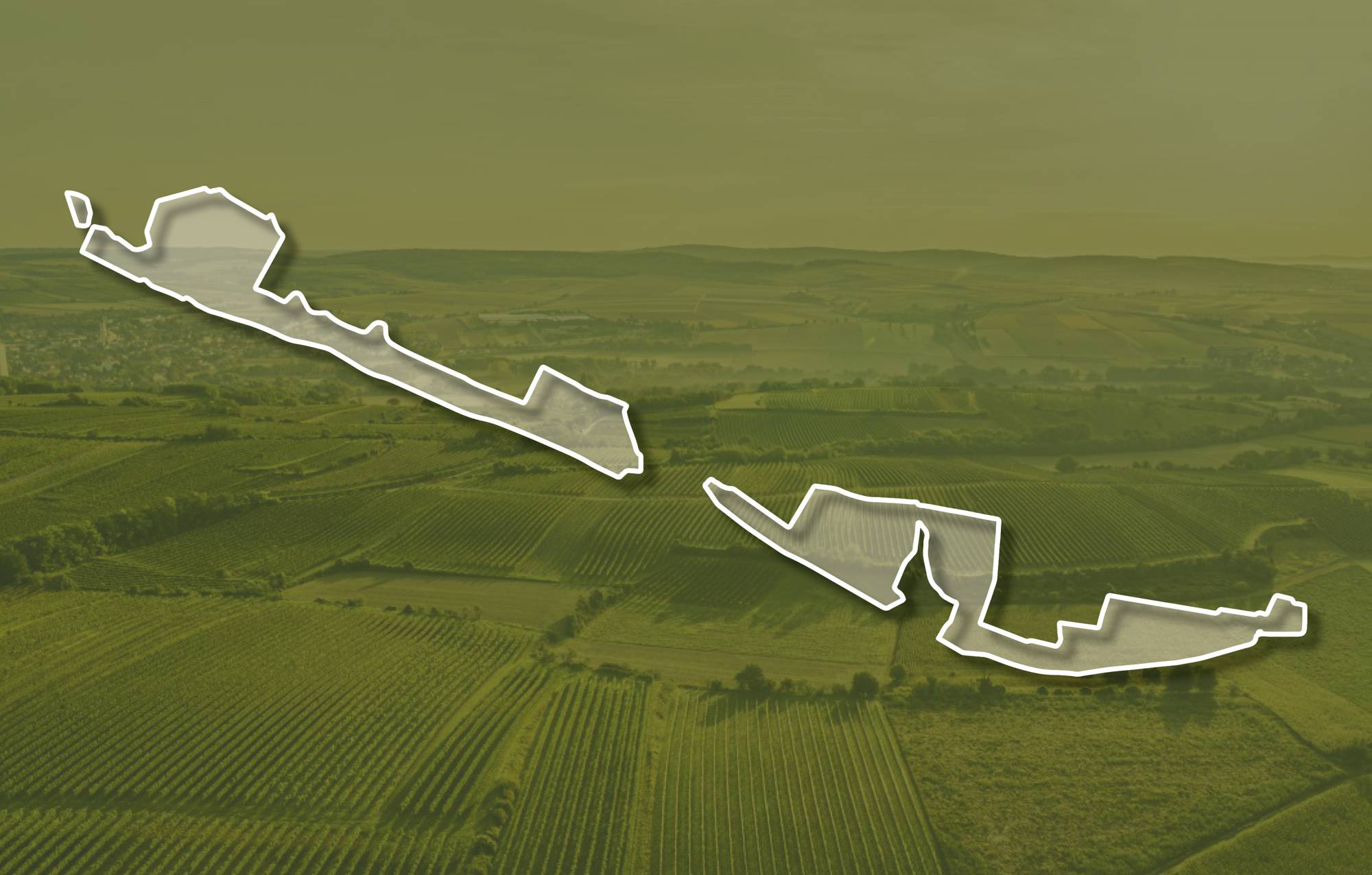
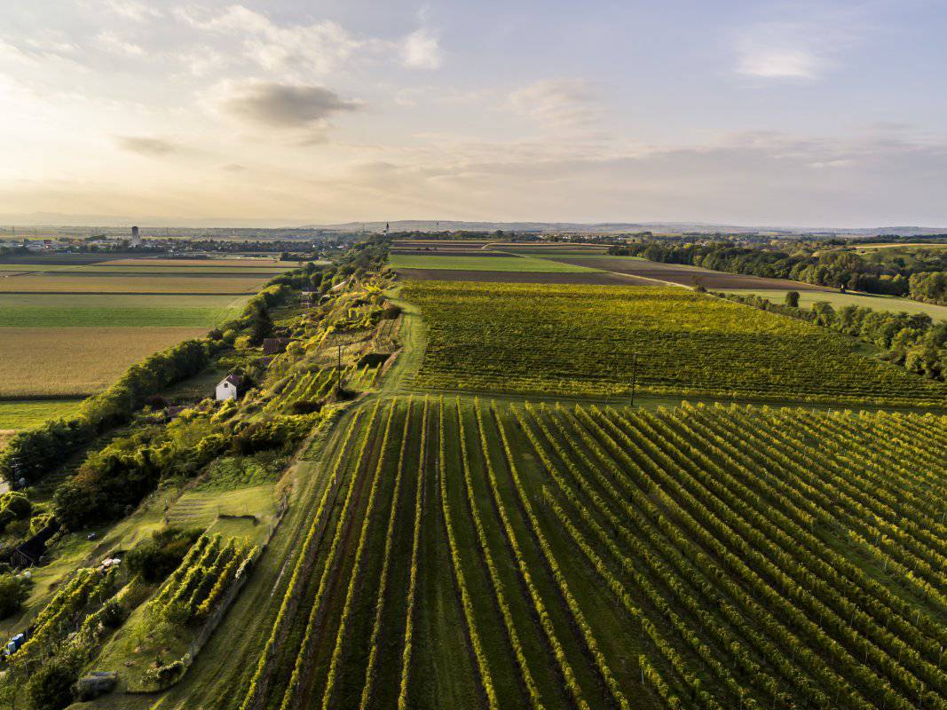
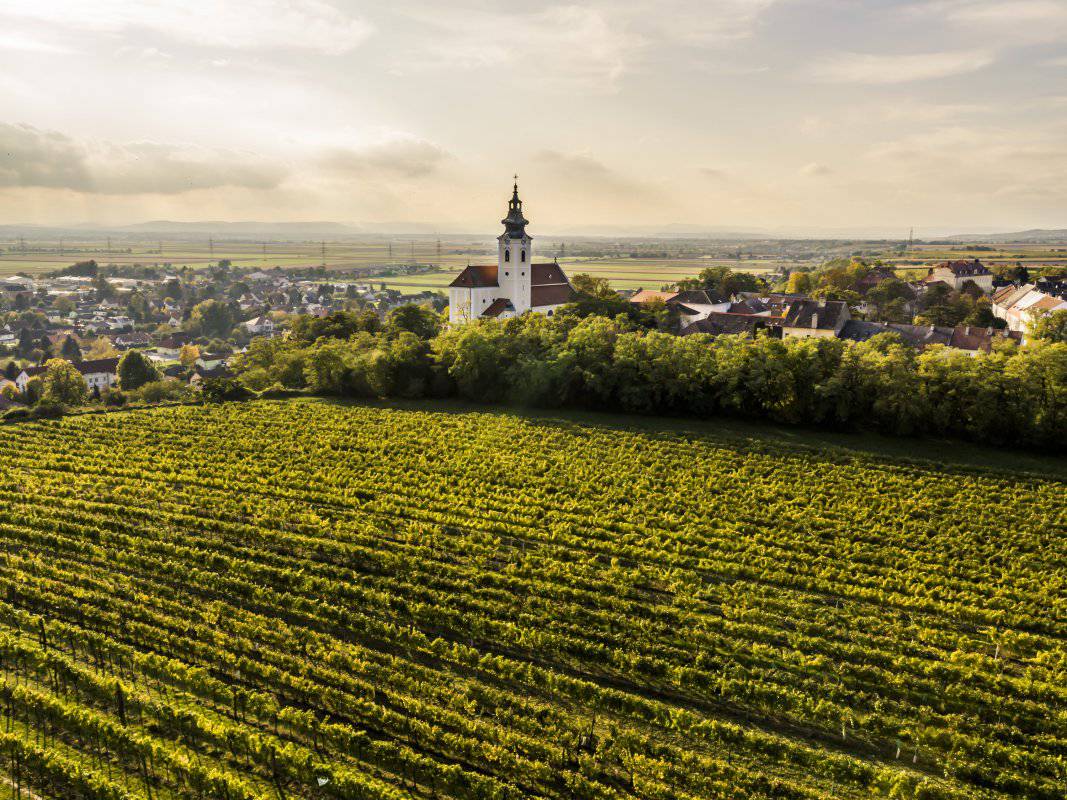
Die Ried BROMBERG zieht von Unterstockstall an der Wagramkante entlang nach Kirchberg und von Hippersdorf Richtung Königsbrunn. Die Weingärten liegen zwischen etwa 180 und 230 Meter Seehöhe, an der Kante sind sie terrassiert und nach Süden und Südwesten geneigt, am Plateau liegen sie flach. Zuunterst sind meist kalkige Sande, manchmal zu Sandsteinen verfestigt, oder Tone-Schluffe des ehemaligen Meeres, das vor etwa 17 Millionen Jahren hier lag, aufgeschlossen. Überlagert werden sie von kalkarmen bis kalkfreien sandigen Kiesen, die einen ehemaligen Donau-Talboden nachzeichnen und auch im Untergrund der mit Löss und Schwarzerde bedeckten Hochfläche liegen. Löss ist kalkhaltiger Gesteinsstaub (Schluff), der in den vegetationsarmen Kaltphasen der Eiszeit aus dem Alpenraum hier angeweht wurde und jetzt einen lehmig-sandigen, immer kalkigen und gut speicherfähigen Boden mit ausgewogener chemischer und mineralogischer Zusammensetzung bildet.
Die Weingärten sind sowohl im Franziszeischen Kataster (1823) als auch in der Administrativkarte (1864-1881) verzeichnet.
Quellen: ÖWM, BFW-eBOD Digitale Bodenkarte, Riedenatlas Wagram 2021, M. Heinrich et al. 2009, GBA 2015: Blatt 39 Tulln, NÖ Atlas-Land Niederösterreich, www.familia-austria.at


This content cannot be displayed because cookies are disabled.
Change settings here.


