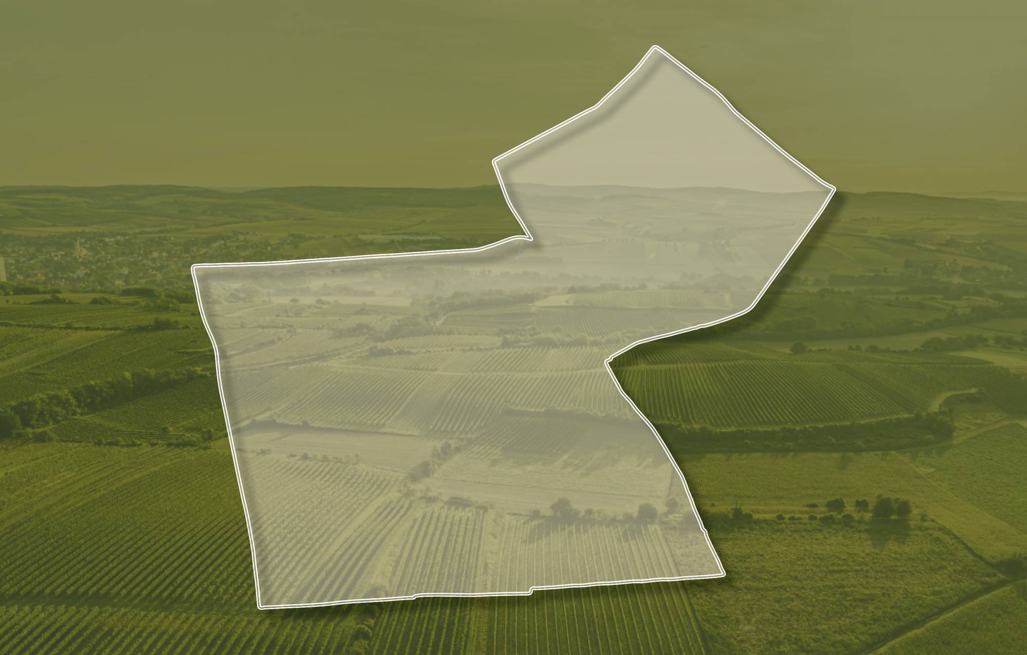
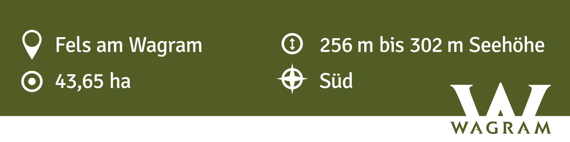
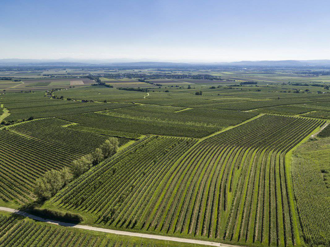
Ried BRUNNTHAL
Beschreibung
Die Ried BRUNNTHAL ist eine nach Süden, im östlichen Teil auch nach Südosten ausgerichtete Terrassenlage. Die Weingärten liegen in Seehöhen zwischen 250 und 310 Meter. Der Boden ist eine kalkhaltige, schluffige Schwarzerde aus meterdickem Löss. Löss ist kalkhaltiger Gesteinsstaub, der in den vegetationsarmen Kaltphasen der Eiszeit aus dem Alpenraum mit den kahlen Vorfeldern der Gletscher und Flussebenen hier angeweht wurde und jetzt einen lehmig-sandigen, immer kalkigen und gut speicherfähigen Boden mit ausgewogener chemischer und mineralogischer Zusammensetzung bildet. Es kommen starke Temperaturunterschiede vor, da kältere Luftmassen aus den nordwestlich gelegenen Waldgebieten hier auftreffen. Die Lage bringt aufgrund des hohen Kalkanteiles mineralisch geprägte Weine hervor, ideal für die vorrangig gepflanzten Sorten Grüner und Roter Veltliner sowie Riesling.
In der Administrativkarte 1:28.800 (1864-1881) sind hier Weingärten, auch damals mit der Bezeichnung Brunnthal, eingetragen. Der Name Ried kommt wahrscheinlich aus den mittelhochdeutschen Wortstämmen „brunn“ für brennen oder heiß und „thal“ für Teil.
Quellen: ÖWM, BFW-eBOD Digitale Bodenkarte, Riedenatlas Wagram 2021, M. Heinrich et al. 2009, GBA 2015: Blatt 39 Tulln, NÖ Atlas-Land Niederösterreich, www.familia-austria.at


This content cannot be displayed because cookies are disabled.
Change settings here.


