Ried DOPPEL
Beschreibung
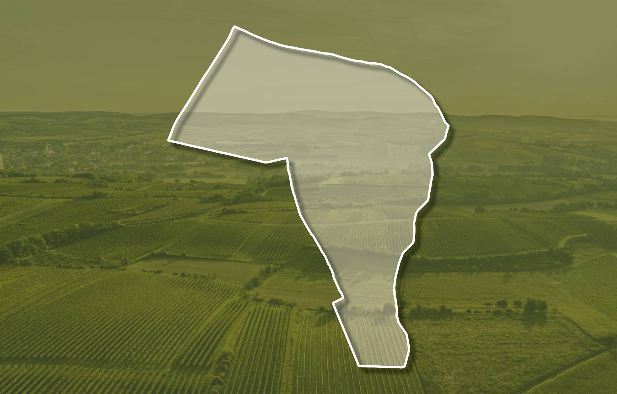
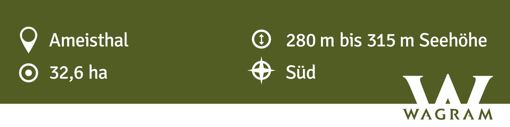
Die Weingärten der Ried DOPPEL schließen westlich an das Ortsgebiet an und erstrecken sich über Seehöhen zwischen etwa 280 und 320 Meter. Sie schauen nach Süden und etwas nach Südosten. Im Untergrund kommen sandige Kiese der Hollabrunn-Mistelbach-Formation zutage, die jedoch partienweise durch Tone-Schluffe ersetzt werden. Im östlichen Teil der Ried liegt Löss mit einem Boden aus Schwarzerde an der Oberfläche. Löss ist kalkhaltiger Gesteinsstaub (Schluff), der in den vegetationsarmen Kaltphasen der Eiszeit aus dem Alpenraum hier angeweht wurde und jetzt einen lehmig-sandigen, immer kalkigen und gut speicherfähigen Boden mit ausgewogener chemischer und mineralogischer Zusammensetzung bildet. Die sandigen Kiese sind ca. 8 - 10 Millionen Jahre alte Ablagerungen eines ehemaligen Flusses, der Ur-Donau, die damals nördlicher als die heutige Donau zum Wiener Becken floss. Die Ton -Schluffe sind Stillwasserablagerungen in Altarmen. Der obere Bereich ist prädestiniert für Roten Veltliner, der frostsichere, luftige Standorte und mittelschwere Böden liebt.
Sowohl im Franziszeischen Kataster (1822) als auch in der Administrativkarte (1864-1881) sind hier Weingärten mit dem heutigen Flurnamen dargestellt.
Quellen: ÖWM, BFW-eBOD Digitale Bodenkarte, Riedenatlas Wagram 2021, M. Heinrich et al. 2009, GBA 2015: Blatt 39 Tulln, NÖ Atlas-Land Niederösterreich, www.familia-austria.at


This content cannot be displayed because cookies are disabled.
Change settings here.


