Ried EISENHUT
Beschreibung
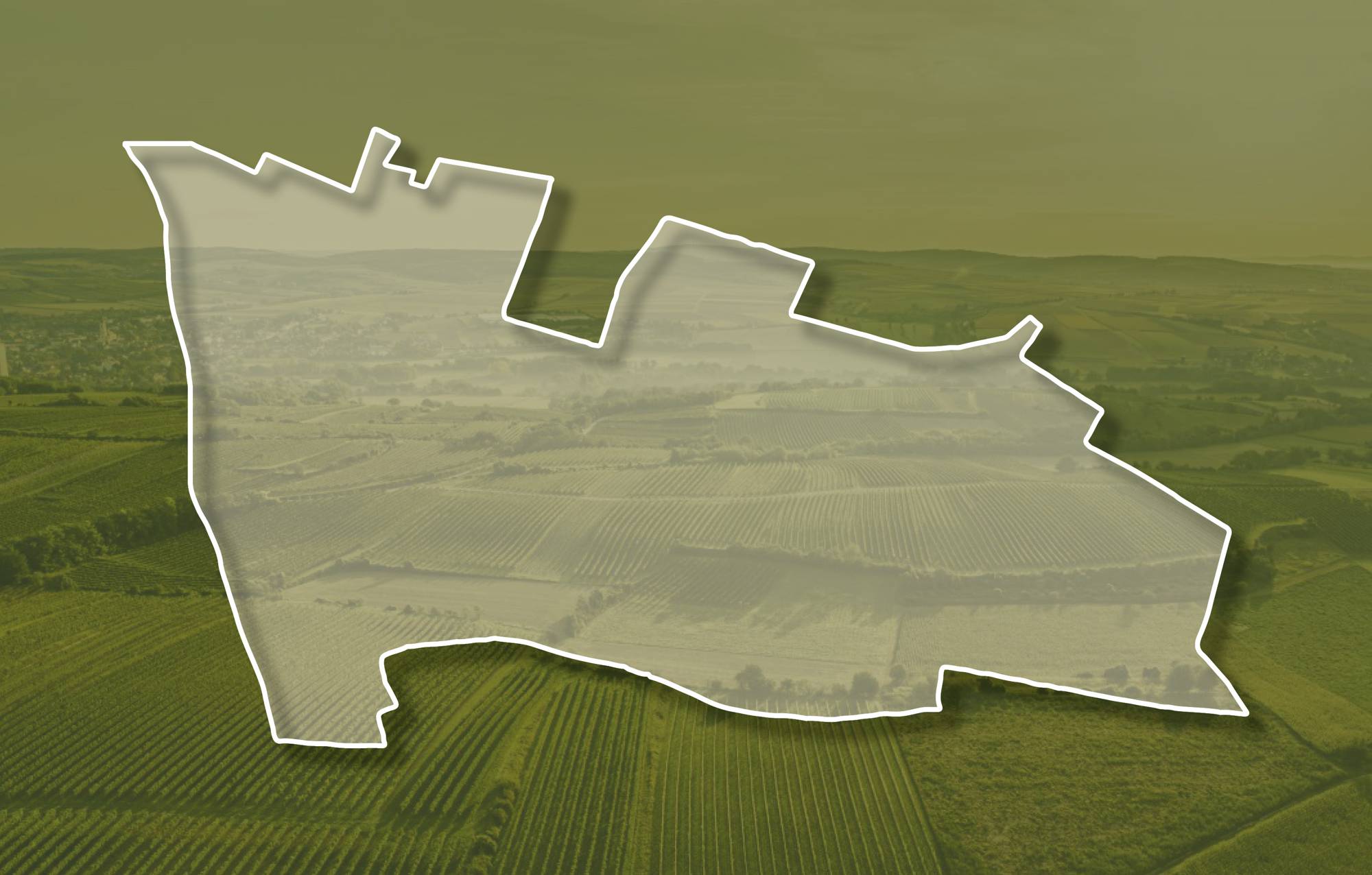
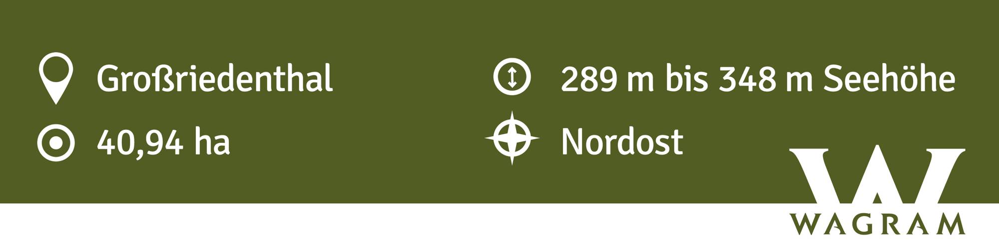
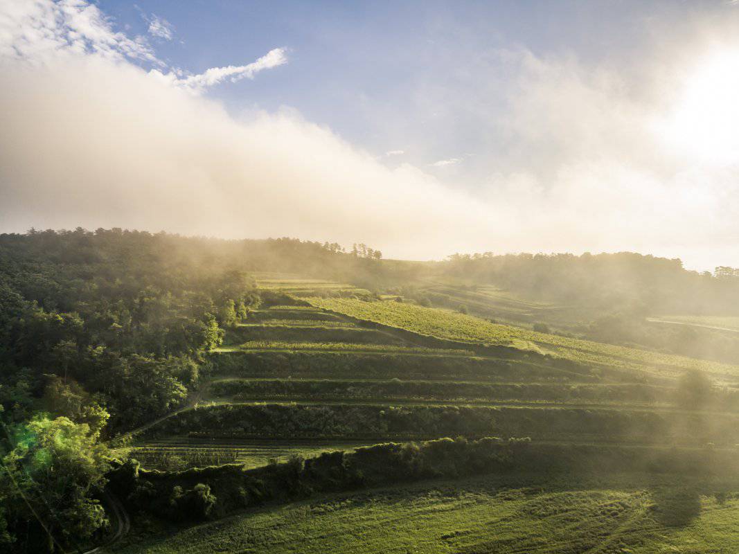
Die Ried Eisenhut liegt am Rücken, der vom Eisenhut nach Südosten Richtung Großriedenthal zieht. Die Weingärten erstrecken sich in Seehöhen zwischen etwa 280 und 350 Meter, sie schauen einerseits nach Nordosten, aber auch nach Südosten und Süden. Den Untergrund bilden die sandigen Kiese und Sande der Hollabrunn-Mistelbach-Formation. Der Kalkgehalt ist gering, aber die Kiese können manchmal zu Konglomerat verfestigt sein. Entstanden sind sie vor ca. 8 -10 Millionen Jahren als Ablagerungen der Ur-Donau, die damals weit nördlicher als heute zum Wiener Becken floss. Im östlichen Teil der Ried sind die Kiese von mächtigen, teils mehrstöckigen Lössablagerungen bedeckt. Löss ist kalkhaltiger Gesteinsstaub (Schluff), der in den vegetationsarmen Kaltphasen der Eiszeit aus dem Alpenraum mit den kahlen Vorfeldern der Gletscher und Flussebenen hier angeweht wurde. Die reinen Südhänge sind sehr heiß und für Löss verhältnismäßig karg. Dadurch sind sie prädestiniert für Riesling und Roten Veltliner.
Die Lage ist bereits im Franziszeischen Kataster von 1823 erwähnt. Der Name rührt wohl von schweren, eisenhaltigen Partien des Konglomerats her, die im Mittelalter am ‚Hut‘, dem Hügel, gesammelt und verarbeitet wurden.
Quellen: ÖWM, BFW-eBOD Digitale Bodenkarte, Riedenatlas Wagram 2021, M. Heinrich et al. 2009, GBA 2015: Blatt 39 Tulln, NÖ Atlas-Land Niederösterreich, www.familia-austria.at


This content cannot be displayed because cookies are disabled.
Change settings here.


