
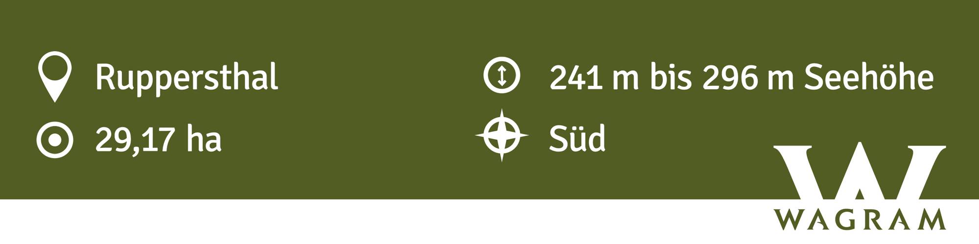
Ried EXELBERG
Beschreibung
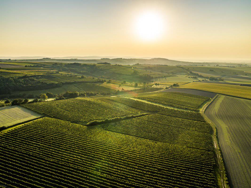
Die Ried EXELBERG ist zweigeteilt und liegt westlich Ruppersthal. Die Weingärten erstrecken sich über Seehöhen zwischen etwa 230 und 300 Meter, sie schauen mit flacher Neigung vorwiegend nach Süden und Südwesten. Die Reben wurzeln in einer tiefgründigen Schwarzerde aus Löss. Löss ist kalkhaltiger Gesteinsstaub (Schluff), der in den vegetationsarmen Kaltphasen der Eiszeit aus dem Alpenraum hier angeweht wurde und jetzt einen lehmig-sandigen, immer kalkigen und gut speicherfähigen Boden mit ausgewogener chemischer und mineralogischer Zusammensetzung bildet. Die Lage ist vorwiegend mit Grünem Veltliner und Rotweinsorten bepflanzt, da immer eine hohe Reife erzielt wird.
Sowohl im Franziszeischen Kataster (1822) als auch in der Administrativkarte (1864-1881) sind hier Weingärten eingetragen, die Flurbezeichnung lautete damals Blamfang für den nördlichen Teil der Ried und Mehlsack für den südlichen. Der Name Exelberg leitet sich vermutlich vom (Öxle)berg ab und bezeichnet hohe Zuckergrade und Reife der Trauben.
Quellen: ÖWM, BFW-eBOD Digitale Bodenkarte, Riedenatlas Wagram 2021, M. Heinrich et al. 2009, GBA 2015: Blatt 39 Tulln, NÖ Atlas-Land Niederösterreich, www.familia-austria.at


This content cannot be displayed because cookies are disabled.
Change settings here.


