Ried EXLBERG
Beschreibung
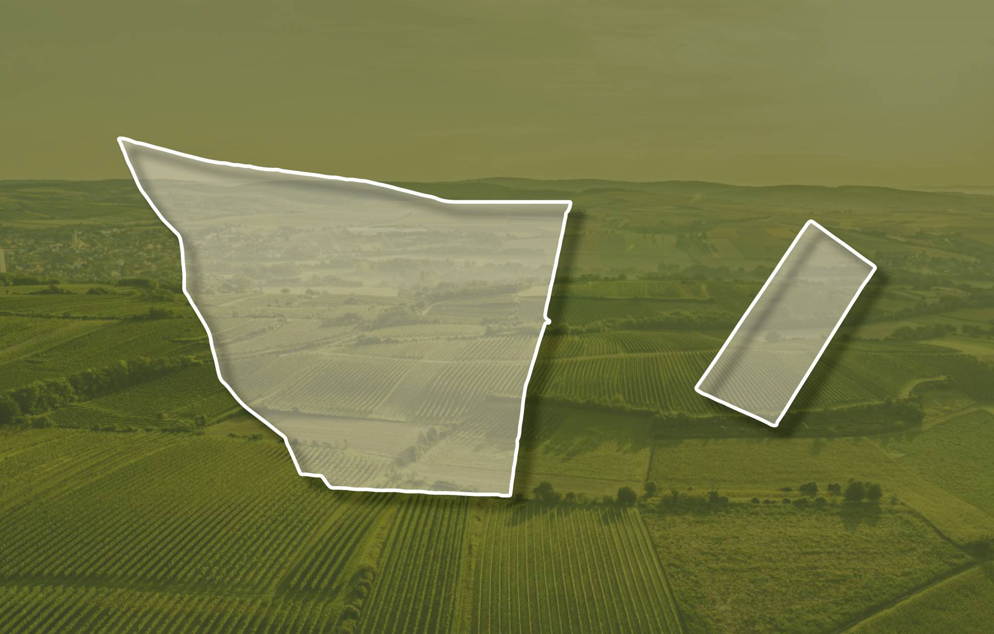
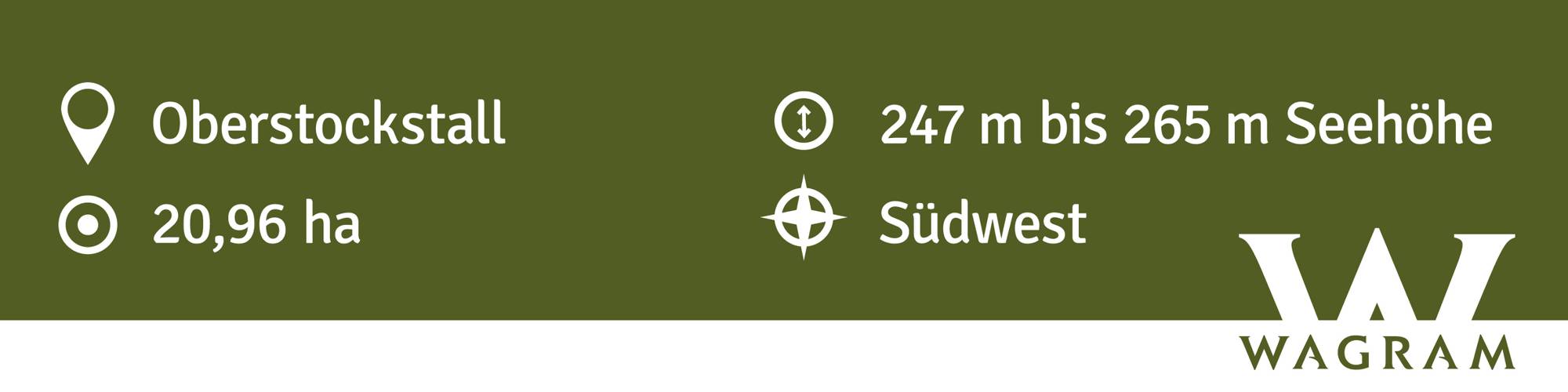
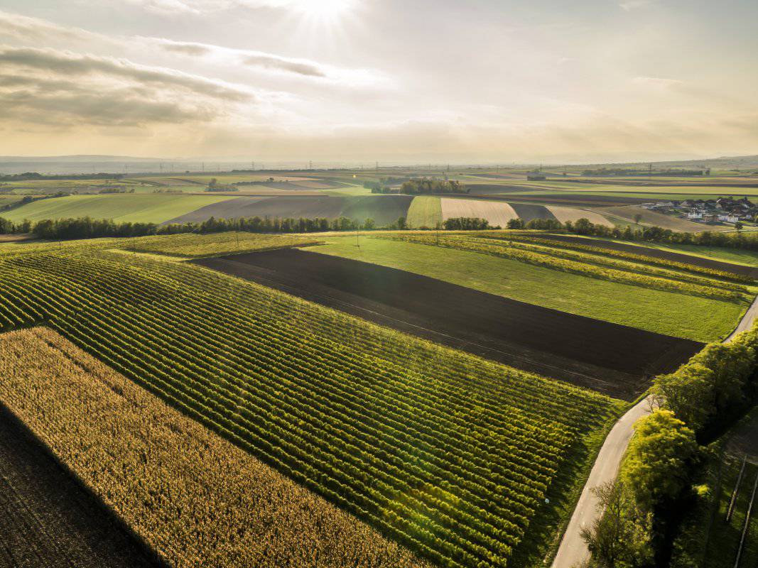
Die Ried EXLBERG liegt nördlich Oberstockstall an der Grenze zu Ottenthal. Die Weingärten liegen zwischen etwa 240 und 270 Meter Seehöhe, sie sind überwiegend nach Südwesten exponiert. An der Kante zum Krampugraben stehen zuunterst kalkarme bis kalkfreie sandige Kiese an, die einen ehemaligen Flusstalboden nachzeichnen und auch im Untergrund der mit Löss und Schwarzerde bedeckten Hochfläche vorkommen. Löss ist kalkhaltiger Gesteinsstaub (Schluff), der in den vegetationsarmen Kaltphasen der Eiszeit aus dem Alpenraum hier angeweht wurde und jetzt einen lehmig-sandigen, immer kalkigen und gut speicherfähigen Boden mit ausgewogener chemischer und mineralogischer Zusammensetzung bildet. Vorrangig gepflanzte Sorte ist der Grüne Veltliner, zudem stehe hier auch Rotweinsorten.
Die Weingärten sind sowohl im Franziszeischen Kataster (1822) als auch in der Administrativkarte (1864-1881) verzeichnet, mit der heutigen Flurbezeichnung. Der Name der Riede Exlberg wurde früher auch Echselberg (Exelberg) genannt. Die Echsel(n) sind junge Ochsen, da sie auf diesen Berg auf die Weide getrieben wurden, wurde er nach ihnen benannt.
Quellen: ÖWM, BFW-eBOD Digitale Bodenkarte, Riedenatlas Wagram 2021, M. Heinrich et al. 2009, GBA 2015: Blatt 39 Tulln, NÖ Atlas-Land Niederösterreich, www.familia-austria.at


This content cannot be displayed because cookies are disabled.
Change settings here.


