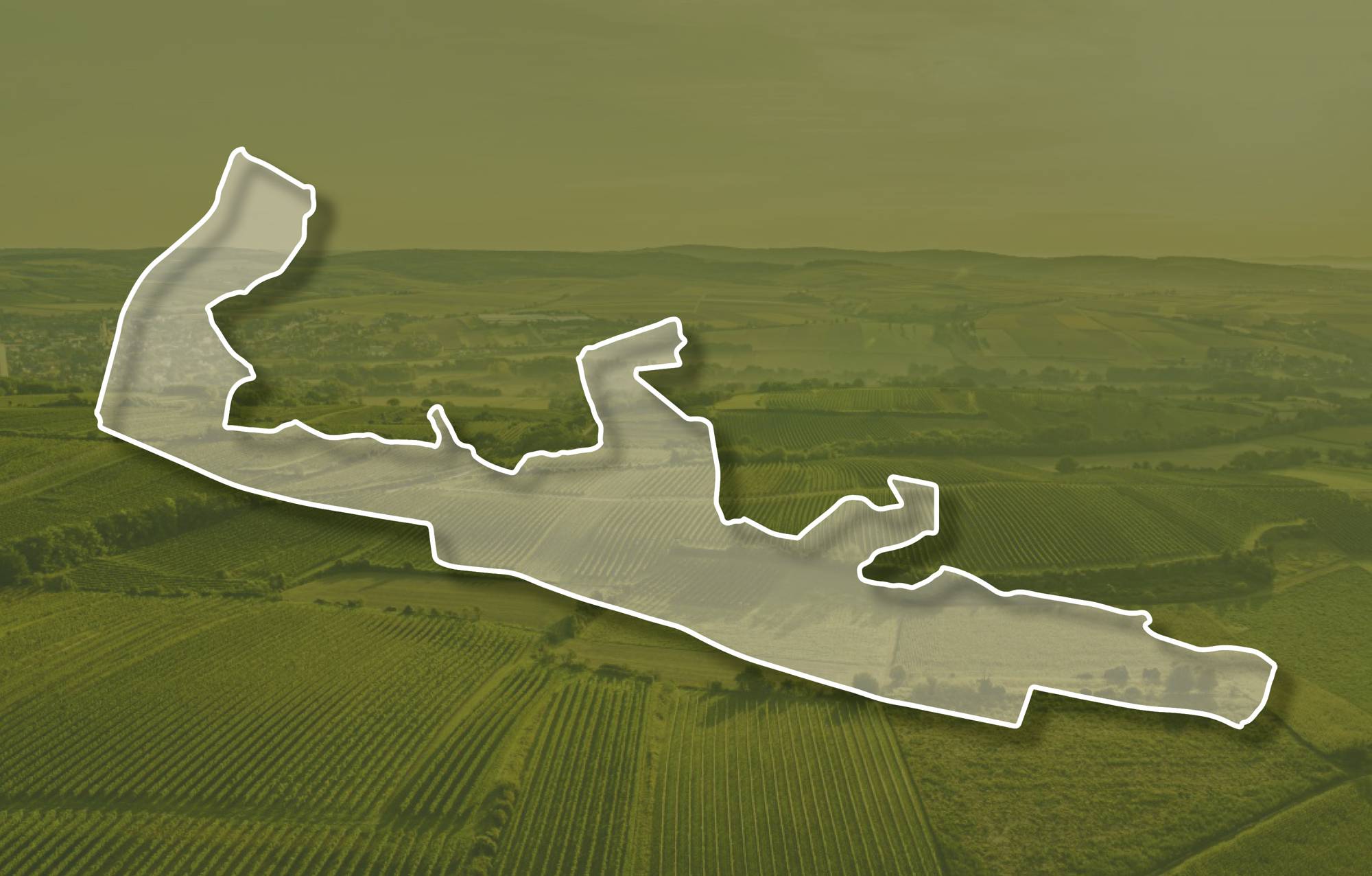
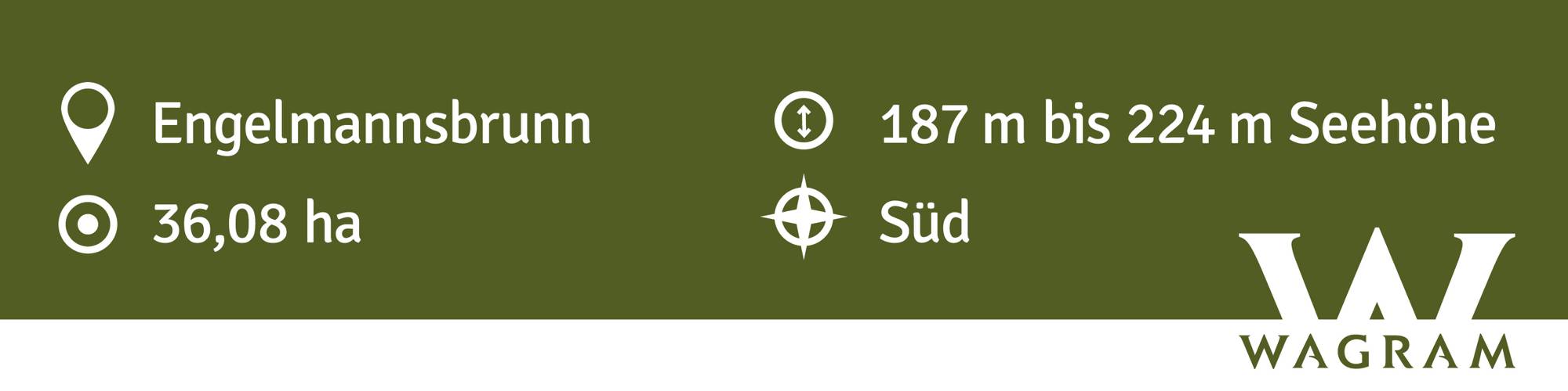
Ried BRÜNDLSTALL – Subried KIRCHENSTEIG
Beschreibung
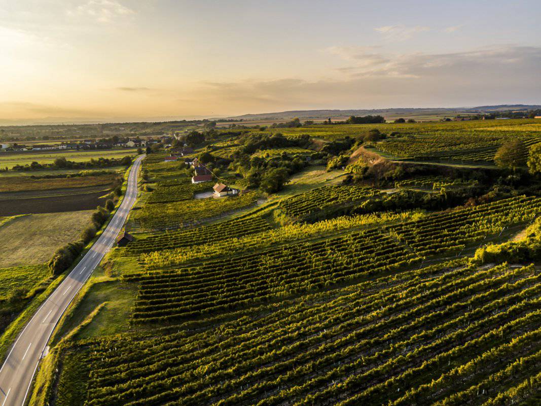
Die Weingärten der Ried BRÜNDLSTALL liegen in Seehöhen zwischen 180 und 230 Meter Seehöhe, sie schauen vorwiegend nach S, auch etwas nach Südwesten und sind an der Wagramkante in Terrassen angelegt, oben am Plateau und unten am Talgrund liegen sie flach. Zuunterst sind etwa 17 Millionen Jahre alte, meist kalkige Tone-Schluffe und Sande der ehemaligen Meeresbedeckung aufgeschlossen. Überlagert werden sie von kalkarmen bis kalkfreien sandigen Kiesen, die einen ehemaligen Talboden der Donau nachzeichnen und auch im Untergrund der mit Löss bedeckten Hochfläche liegen. In diesem frühreifen Teilbereich herrscht sehr karger, steiniger Boden vor, der interessant für die Kultivierung der Sorte Riesling ist.
Eine Quelle im Graben gibt dieser Lage den Namen.
Die Weingärten sind sowohl im Franziszeischen Kataster (1823) als auch in der Administrativkarte (1864-1881) verzeichnet, im Kataster mit der Bezeichnung Wagram.
Quellen: ÖWM, BFW-eBOD Digitale Bodenkarte, Riedenatlas Wagram 2021, M. Heinrich et al. 2009, GBA 2015: Blatt 39 Tulln, NÖ Atlas-Land Niederösterreich, www.familia-austria.at


This content cannot be displayed because cookies are disabled.
Change settings here.


